
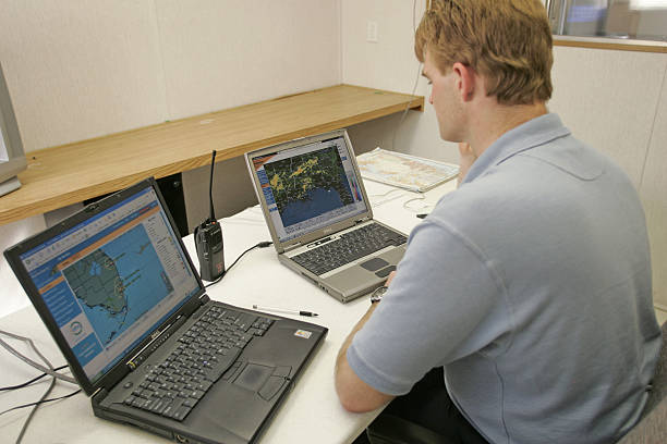
Inside the Playbook: How South Carolina Tracks an Incoming Storm
If you wake up to a tropical system two or three days offshore, your question isn’t whether the cone moved. It’s who in South Carolina is watching the data hour by hour, when the next forecast drops, and which numbers tell you whether to secure the boat, leave early, or hunker down. Here’s how that machine works across the state, from the beaches to the Blue Ridge, with the exact times, phones, gauges, and addresses locals here actually use when a storm bears down.
Who’s watching the skies for you in South Carolina?
Three National Weather Service forecast offices cover the state around the clock, and each one speaks directly to its counties and media partners when a storm threatens. NWS Charleston runs a 24x7x365 operation at 5777 South Aviation Avenue, North Charleston 29406, covering the Lowcountry and coastal waters from the Santee River to the Altamaha. Their in-house WSR‑88D radar, call sign KCLX, scans from Grays, South Carolina, to resolve rain bands, waterspouts, and tornado signatures that spin up in tropical rain shields.
Upstate and Midlands communities get warning and forecast service from NWS Greenville‑Spartanburg, located at 1549 GSP Drive, Greer 29651, and NWS Columbia at 2909 Aviation Way, West Columbia 29170. Wilmington, North Carolina’s office covers the Grand Strand for Horry and Georgetown Counties, which is why Myrtle Beach viewers often see both Charleston and Wilmington products on local TV crawls. If you’re ever unsure which office “owns” your alerts, check the office address above and match it to the county list on your local forecast page.
Statewide coordination funnels through the South Carolina Emergency Operations Center at the South Carolina Emergency Management Division (SCEMD), 2779 Fish Hatchery Road, West Columbia 29172. When storms are brewing, SCEMD shifts the state’s readiness using OPCON levels that run from OPCON 3 (normal daily operations) to OPCON 1 (full alert, SEOC fully activated). That flip to OPCON 1 is your signal the state is staffing around the clock and every agency is in the room.
At the county level, emergency management departments run briefings, open information lines, and push local alerts. For example, Charleston County Emergency Management keeps public-facing office hours of Monday–Friday, 8 a.m.–5 p.m. and publishes storm updates and evacuation zone guidance. If a life-safety message is needed after hours, it will go out through the alert systems and on-air partners regardless of the clock.
When do updates drop, and which ones should you check first?
The cadence matters. The National Hurricane Center issues full advisory packages for Atlantic systems at 5 a.m., 11 a.m., 5 p.m., and 11 p.m. Eastern. When coastal watches or warnings are up, intermediate public advisories fill the gaps at 2 a.m., 8 a.m., 2 p.m., and 8 p.m. That’s why you’ll see the cone and key messages change roughly every six hours, with shorter updates between when the coast is in play. If you only check once, do it a few minutes after those times to allow images and text to refresh.
Local offices translate the national guidance into what it means neighborhood by neighborhood. NWS Charleston’s “briefing” page updates throughout the day during threats and will often include county-by-county rainfall ranges, wind timing by hour, and surge or tornado highlights specific to the tri-county area. On a winter system, they also publish a public report line at 888‑383‑2024 for ice and snow totals, a handy signal that forecasters are actively validating the event in real time.
Transportation and re-entry planning runs on a parallel schedule. The South Carolina Department of Transportation (SCDOT) keeps its traveler information service running 24/7 and posts evacuation overlays and precipitation on the 511 system. From outside the state you can reach it by phone at 877‑511‑4672. For live questions unrelated to 911, SCDOT Customer Service answers at 855‑GO‑SCDOT on Monday–Friday, 8:30 a.m.–5 p.m., including during the preparedness window before any lane reversals or closures are announced.
Which maps, gauges, and indexes actually move decisions here?
Storm surge and river flooding aren’t abstractions. Along the Charleston harbor, the NOAA tide station 8665530 (Charleston, SC) has recorded water levels since the 1890s. It logged a 6.76 ft surge relative to mean higher high water on September 21, 1989, and its three- and six-minute data feeds are what forecasters watch during each high tide push. On the Grand Strand, 8661070 (Springmaid Pier) in Myrtle Beach posted a 4.86 ft peak (also relative to tidal reference) on September 30, 2022. Those two gauges tell you in plain numbers whether the next tide will lap into typical nuisance spots or push farther inland.
Inland, the rivers lag the rain. The Congaree River at Columbia carries an official flood stage of 19.0 ft, and the river set a modern benchmark near 31.8 ft during the October 2015 flood. That context matters when a tropical system crawls north and the Upstate and Midlands drink the remnants. On the Grand Strand, the Waccamaw River at Conway calls 14.0 ft “major flood,” with a crest over 21 ft after Florence in 2018. These are the numbers emergency managers cite when they warn some neighborhoods will see river flooding days after the last rain band passes.
Radar fills the gaps between tide and river readings. The KCLX radar near Grays refreshes every few minutes through multiple elevation scans, which is how the Charleston office pinpoints rain maxima that drive street flooding and short-fuse tornado warnings in feeder bands. Upstate, the KGSP radar in Greer does the same for mountain wave rain and tropical wraparound on the I‑85 corridor. When forecasters say “training echoes” over the same neighborhood, this is the tool they’re watching.
Evacuation decisions lean on a different set of maps. Charleston County uses lettered storm-surge evacuation zones, currently labeled A through F. Zone A includes the barrier islands and immediate coastline (think Folly Beach, Sullivan’s Island, Isle of Palms, Kiawah, Seabrook), while interior zones step inland toward the I‑26 corridor. Horry County divides its coast and inland areas into Zones A, B, and C with Zone A closest to the ocean. SCDOT’s statewide evacuation map was refreshed in April 2026, and county GIS maps let you type an address for the latest assignment before any order goes out.
What alerts will hit my phone, and which ones should I add?
Two alerting systems reach you whether you signed up or not. Wireless Emergency Alerts (WEA) will buzz compatible phones for evacuation orders, flash flood warnings, and tornado warnings based on your handset’s location. NOAA Weather Radio is the always‑on backup many households use to catch alerts overnight or when cell service blips. In the Lowcountry, the Charleston transmitter KHB29 broadcasts on 162.550 MHz. Up the coast, the Aynor/Grand Strand transmitter KEC95 broadcasts on 162.400 MHz. If your radio supports SAME codes, program only your home county to cut down on late‑night alerts from neighbors counties.
Most counties also operate opt‑in text, voice, and email systems geared to local closures and re‑entry messaging. Charleston County’s program is branded as CHSAlerts and runs on the Everbridge platform. Horry County advertises CodeRED enrollment. These are free to the public and sit alongside, not in place of, the federal systems. If you prefer voice hotlines, the City of Charleston Citizen Information Line is 843‑724‑7311, and the Charleston County Citizens Information Line runs at 843‑746‑3900 with a TTY line 843‑746‑3911 and a dedicated Spanish line 843‑746‑3909 during larger events.
Transportation alerts are their own category. The 511 phone service routes you to road conditions statewide by saying a route number or city, and the app displays evacuation routes and precipitation overlays. From out of state, the 511 line is 877‑511‑4672. If you must call SCDOT for a non‑emergency roadway issue outside an active evacuation, their customer service hours are Monday–Friday, 8:30 a.m.–5 p.m. For life‑safety, call 911 first.
Which source should you follow at each stage?
| Source | What you get | Typical update time | Local example |
| National Hurricane Center (NHC) | Forecast cone, key messages, surge and wind probabilities for the entire storm | Full advisories at 5 a.m., 11 a.m., 5 p.m., 11 p.m. Eastern; intermediate at 2/8 | Morning cone shift shows higher surge odds from Santee to Savannah before any local order |
| NWS Local Offices (CHS, CAE, GSP, ILM) | County‑level timing for wind and rain, local surge and tornado risk, briefing graphics | Refreshed multiple times daily during threats | NWS Charleston briefing highlights a 3–6 a.m. wind ramp for the tri‑county area |
| NOAA Tide & River Gauges | Observed water levels to ground‑truth surge and river forecasts | Every 1–6 minutes depending on station | 8665530 Charleston cresting near the evening high tide; Congaree at 19 ft reaches flood stage |
| Alerts to Phone/Radio | Immediate push of warnings and evacuation orders | As issued | WEA tone on your phone for a tornado warning; KHB29 162.550 MHz repeating the same alert |
How do professionals here “read” a tropical threat 3, 2, and 1 day out?
Three days out (72 hours)
Watch the 11 a.m. and 5 p.m. NHC forecast packages for cone shifts and official wording about track confidence. In this window, county managers also check how the storm’s wind field aligns with high‑tide cycles at Charleston and Springmaid Pier gauges. If the largest wind push coincides with a morning or evening high tide, expect early talk of ponding on peninsulas, surge watches, and whether bridges may face high‑wind restrictions during specific hours.
Two days out (48 hours)
Local NWS offices will start hammering timing windows by county: for example, “tropical storm force gusts after 2 a.m.,” “strongest winds 6–10 a.m.,” or “heaviest rain near and east of I‑95.” You’ll also see charts showing expected rainfall ranges by zone instead of one state average. SCDOT’s 511 platform flips on more evacuation overlays at this point, and county sites may publish sheltering details and pet rules if they expect openings.
One day out (24 hours)
Forecasters lock in tide timing and surge heights using the harbor gauges, then shift attention inland to rivers and low‑water bridges. In Charleston County, evacuation zone letters A through F anchor the language of any orders. On the Grand Strand, public messaging leans on Horry Zones A–C and the standard US 501 and US 17 routings. Expect your most actionable push alerts in this window, plus a quick reminder to keep your radio on 162.550 or 162.400 MHz overnight if the worst is timed near dawn.
Key things to know before the next cone moves
- Atlantic hurricane season runs June 1 to November 30. That’s when NHC advisories arrive like clockwork at 5/11 a.m. and 5/11 p.m. Eastern, with intermediate advisories at 2/8 when coastal watches or warnings are up.
- If you live along the harbor or on a barrier island, add the NOAA tide gauge IDs you’ll hear forecasters cite: 8665530 (Charleston) and 8661070 (Springmaid Pier). Each updates within minutes and correlates directly to street‑level flooding you’ve seen before.
- Inland flooding lags. The Congaree River at Columbia hits official flood stage at 19.0 ft, and the Waccamaw at Conway calls 14.0 ft “major flood.” Watch those numbers in the two to four days after landfall.
- Keep two alert paths. Program KHB29 162.550 MHz (Charleston) or KEC95 162.400 MHz (Grand Strand) on a NOAA Weather Radio for overnight coverage, and enroll in your county’s opt‑in system (CHSAlerts in Charleston County, CodeRED in Horry County).
- Travel planning is easier on one screen. The 511 app and phone line (877‑511‑4672 from outside SC) show evacuation routes and a precipitation overlay in real time. SCDOT’s customer service hours are Mon–Fri, 8:30 a.m.–5 p.m. for non‑emergency questions.
- Know where the decisions are made. SCEMD operates from 2779 Fish Hatchery Road, West Columbia and moves the state from OPCON 3 to OPCON 1 as a storm closes in, which is your cue every agency is fully engaged.
- Prefer voice hotlines? The City of Charleston Citizen Information Line is 843‑724‑7311. The Charleston County Citizens Information Line is 843‑746‑3900, with TTY 843‑746‑3911 and Spanish 843‑746‑3909 during larger events.
Reader Q&A
How early should I expect evacuation zones A–F in Charleston County to be mentioned in public briefings?
When a coastal watch or warning is possible, zone letters start showing up in county updates about 48 hours out. That lines up with the 11 a.m. and 5 p.m. NHC advisory cycles and local NWS graphics that translate expected surge and wind timing into zone‑based guidance.
What single number best tells me if downtown Charleston will flood during a landfalling storm?
Check the NOAA harbor gauge 8665530 (Charleston) around the high‑tide windows. That station recorded 6.76 ft during Hurricane Hugo’s passage in 1989, and it’s still the real‑time reference forecasters use to confirm whether water is reaching typical nuisance blocks or pushing into more buildings.
How do I follow alerts if my cell service gets spotty during a storm?
Use a NOAA Weather Radio set to KHB29 162.550 MHz (Charleston area) or KEC95 162.400 MHz (Grand Strand). Those transmitters carry the same warnings your phone would buzz for, and they don’t rely on the cellular network. County opt‑in systems like CHSAlerts and CodeRED are great additions but don’t replace the radio.
Who do I call for road conditions if I’m evacuating from out of state into South Carolina?
Dial the 511 traveler information line at 877‑511‑4672 from outside South Carolina. The service runs around the clock and includes evacuation route overlays and precipitation data. For non‑emergency questions about roadwork or closures in the prep window, SCDOT Customer Service answers Monday���Friday, 8:30 a.m.–5 p.m.
When the forecast turns, match your plan to your threats. If you’re on the coast, marry the NHC times to local NWS surge and tide graphics. Inland, put river stages like the Congaree 19 ft flood threshold and the Waccamaw’s major flood at 14 ft at the top of your checklist, then choose your departure time around those rises rather than the last rain band.
Published: September 10, 2026 · Reviewed by the South Carolina editorial team