
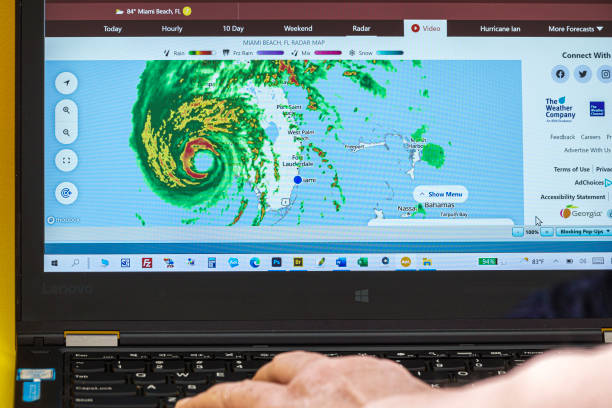
How to Read Charleston’s Weather Radar the Way Locals Do
You wake up to a rumble over the Ashley, your street sits a few inches lower than the neighbors’, and the Charleston Harbor tide is running high. Do you have 20 minutes before the downpour blocks the Crosstown, or two? The answer lives on one screen: the Charleston, SC WSR-88D radar, call sign KCLX, and the way you read it when tides and sea breeze rule the day.
Charleston’s primary Doppler sits inland at Grays in Jasper County, roughly 65 miles from downtown. That siting gives the metro broad coverage but raises the beam a few thousand feet by the time it reaches the peninsula. On the lowest tilt, the beam center is typically around 5,000 to 6,000 feet over downtown, so you’re watching mid-level structure more than the shallow outflow that ponds on Meeting Street. That’s why we pair radar with tide level and ground truth here, not just reflectivity.
The National Weather Service forecast office that programs your warnings runs 24 hours a day in North Charleston, 29406, and you can still reach a forecaster on the public line at (843) 747-5860 during severe events. NOAA Weather Radio for the metro is the KHB29 transmitter on 162.550 MHz, with routine weekly tests most Wednesdays weather permitting. When the sky is noisy and the power flickers, that radio plus the radar loop is the Lowcountry kit.
Where the Charleston Radar Sits, and What That Means for Your View
KCLX is the National Weather Service’s S-band WSR-88D for our area, physically located near Grays in the inland Lowcountry. Inland placement means the beam climbs as it travels toward the coast. Over the peninsula, the lowest tilt often samples several thousand feet above the surface, so the radar can underestimate shallow splash-and-dash cells hugging the immediate shoreline and marshes while still painting strong cores over the Summerville ridge line clearly.
This geometry also explains common “surprises” in town. A summer sea-breeze shower can look light on reflectivity yet produce intense curb-to-curb runoff along the Crosstown because the lowest tilt is sampling above the heaviest drop sizes. In tropical rainbands, mid-level reflectivity gradients over the harbor can look uniform while the real-world hazard is brief gusts and quick bursts of 1–2 inches per hour in narrow swaths. Treat low-topped warm rain with respect here, even when tops don’t look imposing.
Single-site scans from KCLX typically refresh on the order of a few minutes, faster in storm mode. When the Charleston site is offline for maintenance, the forecast office points you to adjacent coverage from Jacksonville and Wilmington to maintain situational awareness. The office operates 24x7x365, issuing warnings for Southeast South Carolina and nearby Georgia counties, so products continue even when a hardware swap is in progress at the dome.
NOAA Weather Radio remains the simplest backstop when cell coverage sags. For the Charleston metro the programmed transmitter is KHB29 on 162.550 MHz, with the antenna position published for mariners. Most Wednesdays around midday, the system pushes a Required Weekly Test so you can confirm your receiver tones and same-code programming are alive. If storms threaten, that test can be postponed, so don’t mistake a quiet noon for a failed receiver on an active day.
One more local constant to frame what you see on radar: the Charleston Harbor tide gauge at station 8665530 defines minor coastal flooding beginning near 7.0 ft MLLW. If your loop shows a coastal band aimed at the Battery within an hour of that level, anticipate nuisance water on low stretches even when reflectivity isn’t alarming. Radar plus tide is the Charleston decode.
Products That Matter On KCLX Before, During, and After Storms
Before storms: seeing the setup
On summer afternoons a thin, pale line “snakes” inland from the beaches on the lowest tilt. That’s the sea-breeze convergence. Over John’s, James, and Daniel Islands, the line often stalls or kinks where marsh fingers and river breezes collide. If that line brightens and slows between 1 and 4 pm, expect pulse updrafts from West Ashley to Goose Creek an hour later even if the morning forecast looked quiet. The office is staffed at all hours, and radar-based mesoscale discussions will appear ahead of any watch, but you can spot the convergent boundary yourself long before lightning counters spike.
Check velocity for inbound/outbound couplets along the boundary near the Ashley River. We rarely see tornadic rotation on a pure sea-breeze day, but brief microbursts from collapsing cells still show as outbound pulses. A quick glance at the terminal forecast for KCHS is helpful, but remember the TAF cadence is every six hours and adjusts as forecasters see boundaries on radar. Your radar loop will “nowcast” the boundary better than any text when the seabreeze wobbles.
During storms: what drops the water
Dual-pol products shine in Lowcountry rain. Correlation coefficient helps you spot hail or debris, but the bigger Charleston trick is melting-layer identification. In warm-season events the bright band sits low, so a pocket of high reflectivity near 8–10 kft can be more melting than menace. Focus on Specific Differential Phase (KDP) to track real-time rainfall rates into the peninsula. A KDP spike feeding up the Ashley is the signature that ponds gutters in minutes even when tops look modest.
Mariners on the harbor and Cooper watch for velocity shear along band edges. While sustained waterspouts are uncommon, quick spin-ups on bands just offshore do occur. Over marsh and open water, these can be invisible at street level. If KCLX shows a tight gradient racing over the harbor with reflectivity scallops on its leading edge, respect the gust potential on the Ravenel rather than waiting for a gust report to hit social feeds.
After storms: what stays flooded
When convection passes but the harbor remains above 7.0 ft MLLW, radar can tempt you to relax because reflectivity fades. Pair the quiet loop with the tide plot. A lingering onshore breeze under 20 kt that pins water in the harbor will slow drainage in downtown and on the outer reaches of the marsh. If a post-storm band pivots back across Daniel Island with modest 25–30 dBZ echoes while the gauge sits near 7.2 ft, expect another round of ponding on secondary roads before the tide turns.
The NOAA Weather Radio weekly test is a handy rehearsal for this phase. If your receiver doesn’t chirp most Wednesdays, fix it before the next coastal low. Program the KHB29 transmitter frequency and your SAME county codes so a late-night flood advisory wakes you even when your phone is face down and the radar app is closed.
Tides, Rain, and Road Decisions: Pairing Radar With Water Levels
Charleston’s paved reality is as tidal as it is meteorological. The harbor’s 8665530 gauge is the reference forecasters and emergency managers use when they say “minor” or “moderate” flooding. For practical decisions, treat it like a second radar product. When the gauge is cresting around 7.0–7.5 ft MLLW and KCLX shows training echoes along the peninsula axis, your odds of finding dry detours shrink fast.
One reliable workflow on wet-surge mornings is to set a split screen: base reflectivity on the lowest tilt to see the onshore push, then KDP or precipitation rate in the second pane if your software supports it. If KDP spikes blossom over James Island while the river gauge ticks up, plan around longer backups on Folly Road rather than hoping a lull fixes it. This is also where the 24-hour staffing in North Charleston matters. Public information statements often mention the current tide state and any expected nuisance flooding window during king tides; having the phone line number handy helps confirm the window when a squall lingers longer than your model app implied.
For mariners and dockside operations, use the same pairing. A clean band of 20–30 dBZ echoes sweeping the jetties during a rising tide is a different hazard than 45–50 dBZ cores. The first raises visibility and slick-deck risks with steady light rain; the second adds short, strong gusts that challenge lines and ladders. NOAA Weather Radio’s continuous audio on 162.550 MHz keeps the marine warnings in your ear while your eyes stay on lines and moorings.
Finally, think upstream too. KCLX covers well beyond the county line; a persistent band over the Edisto Basin or along I-26 upstream of the peninsula can load creeks that drain into town long after the last downtown echo disappears. Reflectivity downrange plus a harbor gauge still high equals another drain cycle to respect.
Apps and Tools Lowcountry Spotters Actually Use
Some tools are free, some are paid, and all can be read wrong if you don’t think like a Charlestonian. Here’s how locals mix them, and what they cost or provide out of the box.
| Option | What you get | Cost/Access | Why it matters here |
| Enhanced NWS Radar website | Single-site KCLX products, national mosaic, storm-based warnings, and quick loops without plugins. | Free | Fast check on the lowest tilt when tide is high and you need a yes/no on approaching bands. |
| RadarScope Pro Tier One | Extended loops, lightning, watches/statements, mesoscale discussions, and multi-pane on mobile. | $9.99/year subscription | Multi-pane lets you park base reflectivity beside KDP to judge rain rates over the harbor in real time. |
| RadarScope Pro Tier Two | Longer loops, Level II archive, GOES satellite, MRMS, model fields, and cross-platform features. | $99.99/year or monthly option | Climo and satellite layers help when tropical bands evolve faster than surface obs update. |
| GRLevel3 (Windows) | Highly configurable Level III viewer with custom color tables and detailed panel controls. | $79.95 one-time license | Desktop clarity for long watches. Easy to script and snapshot sea-breeze lines and training bands. |
| NOAA Weather Radio KHB29 | 24/7 audio of NWS warnings and routine products for the Charleston area on 162.550 MHz. | Free broadcast over the air | Gives you alerts even if internet or power goes spotty. Weekly Wednesday test helps you confirm reception. |
Training is part of the toolkit too. The NWS Charleston office runs free virtual SKYWARN spotter classes on a regular schedule. Sessions take about two hours, and you receive instructions for your certificate by email. In a place where sea-breeze outflows turn a quiet loop into a flooded block in 30 minutes, being trained to report what you see bridges the gap between the beam and the street.
Lowcountry Radar Pitfalls You Can Avoid
Sea-clutter and anomalous propagation. Overnight and early mornings, stable marine layers can bend the beam back toward the surface and light up the coastal waters in low reflectivity mottling. If your loop shows a smooth, stationary gray-green smear over the Atlantic with no matching echoes inland and dry obs elsewhere, that’s propagation, not rain. Check velocity and dual-pol to confirm low correlation and weak motion before you call it a shower.
Shallow warm rain. Our summer downpours often have low tops and warm cloud bases. The lowest tilt samples mid levels here, so those tropical showers can look underwhelming. Use KDP where available; a narrow stripe of high KDP from Johns Island into downtown with a falling barometer out of the southeast is your signal to reroute long before social reports catch up.
Beam blockage is not the issue, beam height is. Unlike mountain West radars, KCLX doesn’t fight terrain. Instead, the inland siting lifts what you see above the ground layer by the time it reaches the harbor. That favors catching the “skeleton” of lines and bands but downplays fine-grained low-level clutter like shallow surface vortices. It also means gust fronts can be sneaky on the peninsula until they grow.
Composite traps. Mosaic and composite views in apps are great for a quick area snapshot, but they can smear thin boundaries that matter to Charleston commutes. If a composite loop looks like a blunt brushstroke along the coast, drill into the single-site KCLX lowest tilt to see if a sharp line is actually racing up the marsh fingers toward Mount Pleasant.
Tide-blind decisions. Many radar users focus only on color and motion. In Charleston, reflectivity is just one input to a flooding decision. If the harbor gauge is climbing toward 7.0 ft MLLW while a persistent band angles across the peninsula, you do not need 60 dBZ to see street water. Treat the gauge like a radar product and your risk calls improve.
Silenced radios. Because the weekly NOAA Weather Radio test is routine, some users mute it and forget. Don’t. Charleston’s required weekly tests most Wednesdays are your rehearsal for hurricane season. If your receiver doesn’t chirp, adjust SAME codes or antenna before the next tropical wave appears.
Key Things To Know When Reading Charleston Radar
- KCLX sits inland at Grays, so the lowest tilt rides around 5,000–6,000 feet over the peninsula. Expect shallow warm rain to look weaker on reflectivity than it feels at street level.
- Charleston Harbor minor flooding starts near 7.0 ft MLLW. Pair that gauge with radar to judge nuisance flooding windows downtown and across the islands.
- Use dual-pol products like KDP to estimate rainfall rates when sea-breeze showers blossom. KDP spikes over the harbor signal quick ponding even with modest tops.
- Keep NOAA Weather Radio on 162.550 MHz (KHB29). The routine Wednesday test confirms your alert chain before hurricane season stress tests everything else.
- Know your tools’ costs and limits. The NWS radar site is free, RadarScope Pro Tier One is $9.99/year, Tier Two adds deeper data at $99.99/year, and GRLevel3 runs a $79.95 one-time license.
- Training is free. NWS Charleston’s virtual SKYWARN classes cost $0 and make your reports more useful on days when sea-breeze boundaries outpace model guidance.
Reader Q&A
Why does a “light green” return sometimes flood my block in downtown while the radar looks unimpressive?
KCLX is inland, so the lowest tilt is several thousand feet above the peninsula. Shallow warm rain can look weak aloft while dumping large drops at the surface. Pair the lowest-tilt reflectivity with KDP for rainfall rates and check the harbor gauge, where minor coastal flooding begins near 7.0 ft MLLW.
Is there a quick way to confirm my alert setup without waiting for a storm?
Yes. The Charleston-area NOAA Weather Radio transmitter KHB29 on 162.550 MHz conducts a routine weekly test most Wednesdays, weather permitting. If your radio doesn’t tone, fix SAME codes or reception before the next event. The NWS office in North Charleston staffs the phones 24/7 if you need help interpreting warnings.
Which app should I use for Charleston’s summer sea-breeze storms?
The free NWS radar site is a solid baseline for quick checks. If you want multi-pane views to watch base reflectivity beside KDP, RadarScope Pro Tier One is $9.99/year. GRLevel3 on Windows is a configurable one-time purchase at $79.95 for long watches and snapshots of sea-breeze lines.
When should I worry more about tides than reflectivity colors?
Anytime the harbor gauge trends toward or above 7.0 ft MLLW. Light-to-moderate echoes that align with high tide can cause nuisance flooding downtown even without towering cores. Radar tells you where it’s raining. The tide gauge tells you where the water will stay.
Published: September 9, 2026